

ZABAGED® - Altimetry - DMR 4G. Digital Terrain Model of the Czech Republic of the 4th generation in S-JTSK, Bpv
| Product information | ||
|---|---|---|
 | Name | ZABAGED® - Altimetry - DMR 4G. Digital Terrain Model of the Czech Republic of the 4th generation in S-JTSK, Bpv |
| Commercial code | 64110 | |
| Export unit | SM 5 map sheet | |
| Unit price | No charges | |
| Export formats | LAZ | |
| Coordinate systems | S-JTSK / Krovak East North, Výškový systém baltský - po vyrovnání | |
| Distribution | 


| |
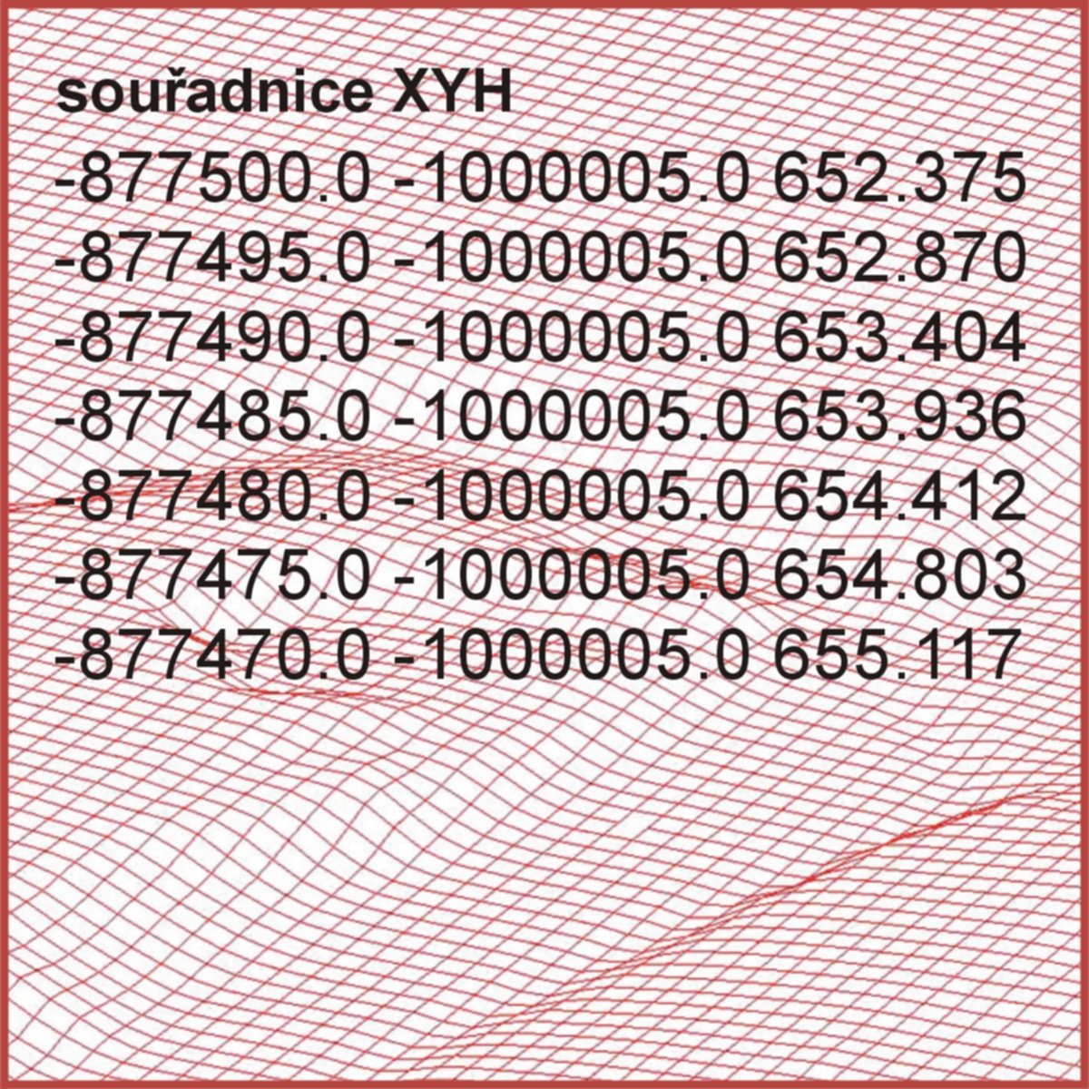
| Product description | The Digital Terrain Model of the Czech Republic of the 4th generation (DMR 4G) represents a picture of natural or by human activity modified terrain surface in digital form as heights of discrete points in a regular grid (5 x 5 m) with coordinates X,Y,H, where H means the altitude in the Baltic Vertical Datum - After Adjustment with total standard error of 0.3 m of height in the bare terrain and 1 m in forested terrain. The model is based on the data acquired by altimetry airborne laser scanning of the Czech Republic territory between years 2009 and 2013. DMR4G is established to analyse terrain situation at regional scale and character, e.g. for extensive transport and water management projects planning, natural phenomena modelling etc. | |
| Update cycle - update status | DMR 4G je Zeměměřickým úřadem od roku 2017 průběžně aktualizován v návaznosti na aktualizaci DMR 5G. Update state | |
| Conditions applying to access and use | No charges Creative Commons CC BY 4.0 License According to Regulation No 31/1995 Sb. | |
| View data |
Web map application Služba WMS | |
| Data download |
Atom service Export of a current extent Pre-defined files download - selection above the map | |
| Contact - product information | Land Survey Office, e-mail: ZU-obchod@cuzk.gov.cz | |
Product last update:
2025-01-09
2025-01-09
Information last update:
2025-03-06
2025-03-06
 RSS 2.0 Geoportal ČÚZK